by Catherine Schmitt
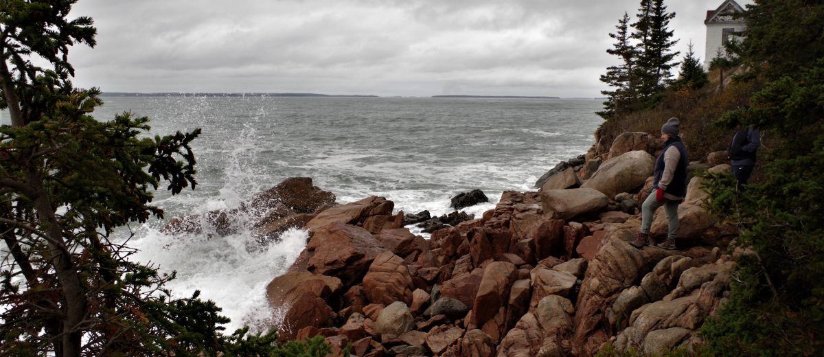
On October 28, 2019, high tide in Acadia National Park was over 12 feet. With a lot of rain in the days before and steady northeast winds, water levels were high everywhere. Waves lapped at the picnic area on Thompson Island, and crashing surf at Bass Harbor Head made this popular vantage point dangerous for people attempting to photograph the lighthouse. The beach at Pretty Marsh was underwater, the stairway nearly submerged.
This so-called “king tide” provides a glimpse into hazardous conditions: imagine the damage that could result if a hurricane or nor’easter storm had coincided with the high tide.
Isaac Ginis, a professor of oceanography at the University of Rhode Island, studies the interaction between Atlantic storms, ocean waves, high winds, and the sea-air surface layers. His research has helped improve forecasts of hurricane intensity. He is now developing models of storm surge and coastal flooding for Acadia National Park, Boston Harbor Islands National Recreation Area, and Cape Cod National Seashore.
His research findings will inform visualizations developed by Peter Stempel, Provost Fellow at Rhode Island School of Design, who works at the intersection of art, design, and science.
Over the next three years, I will be working with Ginis, Stempel, and the National Park Service to help evaluate the research results, visualization tools, and their potential uses and misuses, and working with each park to create products and programs to enhance understanding of storm surge and coastal flooding. We will also develop and implement a regional strategy to improve coastal climate communication so that park visitors and local communities across the northeastern U.S. can prepare for and adapt to changing conditions.