by Ben Capuano, 2021 Intern from College of the Atlantic
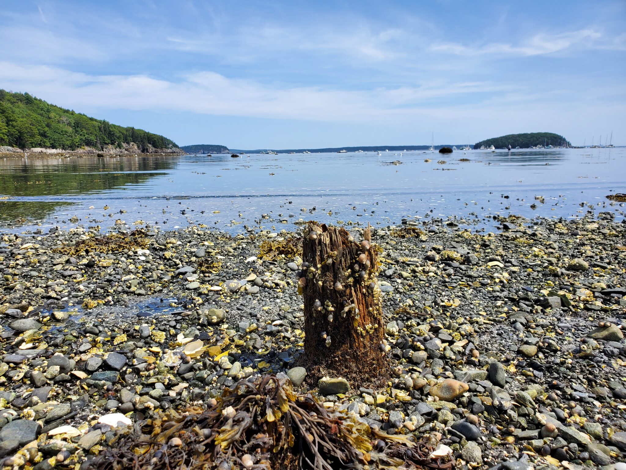
The intertidal zones present within the land that today makes up Acadia National Park have attracted researchers for over a century. From the rocky shores of Seawall and Bar Island to the mudflats of Thompson Island to the sheer headlands of Thunder Hole and Otter Cliffs, a remarkable amount of diverse ecosystems fall within the confines of Acadia. Chronicling the changing compositions of these ecosystems has assumed immense importance as the Gulf of Maine continues to warm rapidly. But although Acadia has a solid record of intertidal research observations, sources can often be hard to locate, access, and compare against one another. The Intertidal Synthesis Project seeks to alleviate some of these difficulties.
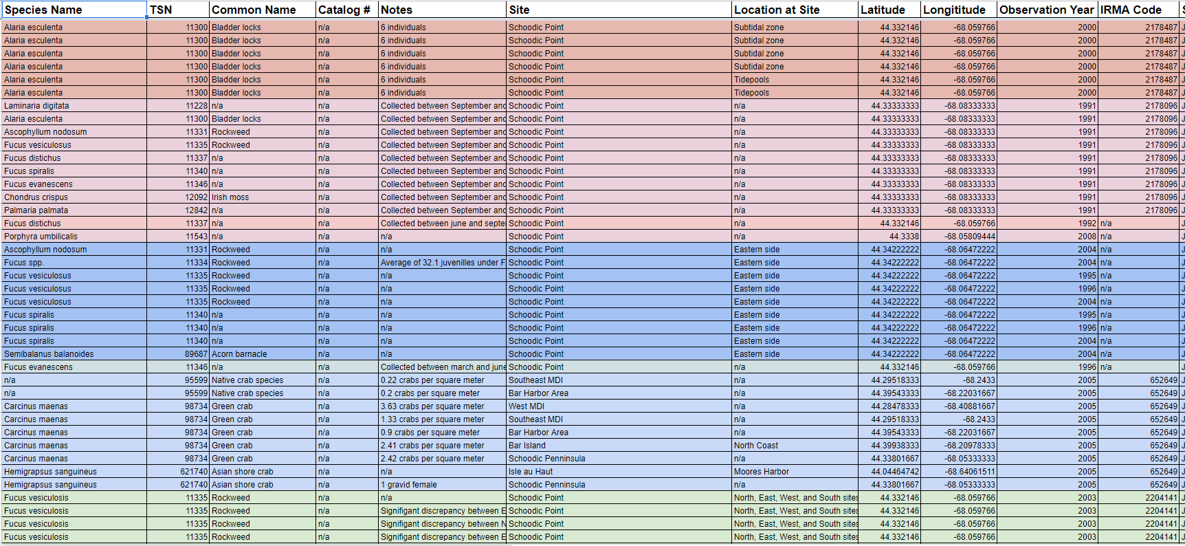
We have compiled an Excel table containing 7,781 unique observations of algae, invertebrates, fish, and other intertidal organisms. These observations span over a century of time from 1903 to 2018, although the majority of observations occur after 1997. Seventy percent of sources have a corresponding document in National Park Service digital archives (IRMA); 458 observation entries have corresponding cataloged specimen identification numbers at collections housed at Mount Desert Island Biological Laboratory and Acadia National Park. By concentrating as much observational data as possible from as many sources as possible into a single spreadsheet, this project hopefully will make it easier for researchers to access relevant information in a format more conducive to their needs.
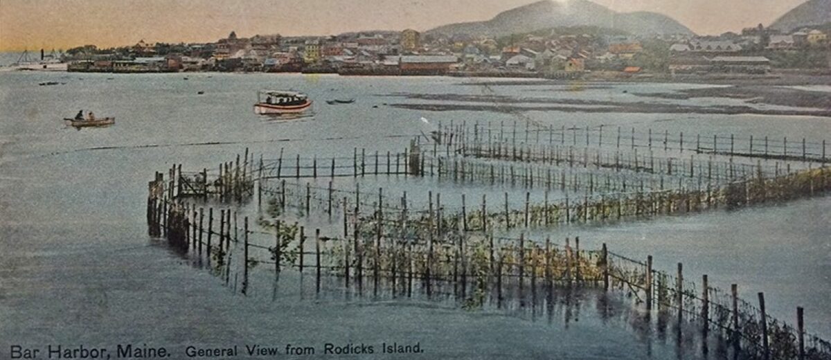
Alongside collecting as much data as possible, another major objective of the project was to format information in ways that made comparison easy. During the time elapsed by the project, the names of locations across the park and the scientific names of organisms were anything but consistent. In the earliest source of the project, Augusta Foote Arnold’s The Sea-Beach at Ebb-Tide, the author described seeing “cuttlefish” at Rodick’s Weir in 1903. Today the term cuttlefish is most commonly used to describe organisms belonging to the order Sepiida, however no species in the order has a range including the Americas. Likewise Rodick’s Weir, seen in the photo above from Jesup Memorial Library, no longer exists as the land it was built on surrounding Rodick’s Island is now park property. Instead of being referred to as Rodick’s Island, this section of the park is today most commonly referred to as Bar Island.
Observations like these present a conundrum to archivists: should the original language be retained or should antiquated terms be replaced for equivalents better suited for potential readers today? For Intertidal Synthesis, we tried to keep the best of both worlds. The original terms of the observation – the common name “cuttlefish” and the location of “Rodick’s Weir” – were recorded in the entry on the table. However, the entry also includes a taxonomic serial number (TSN) for cephalopods and latitude/longitude coordinates for the site at today’s Bar Island. By including the TSN for cephalopods in general, interested researchers can still find relevant records they would have excluded by searching for categories excluding cuttlefish. In a similar sense, researchers looking for records of Bar Island can find relevant data not labeled under the Bar Island name.
This and other compromises were made so that the Intertidal Synthesis Project can be as useful to as many researchers as possible. The Excel file containing the spreadsheet along with a Word document explaining how to use it will be uploaded to IRMA for public access.