by Catherine Schmitt, Science Communication Specialist
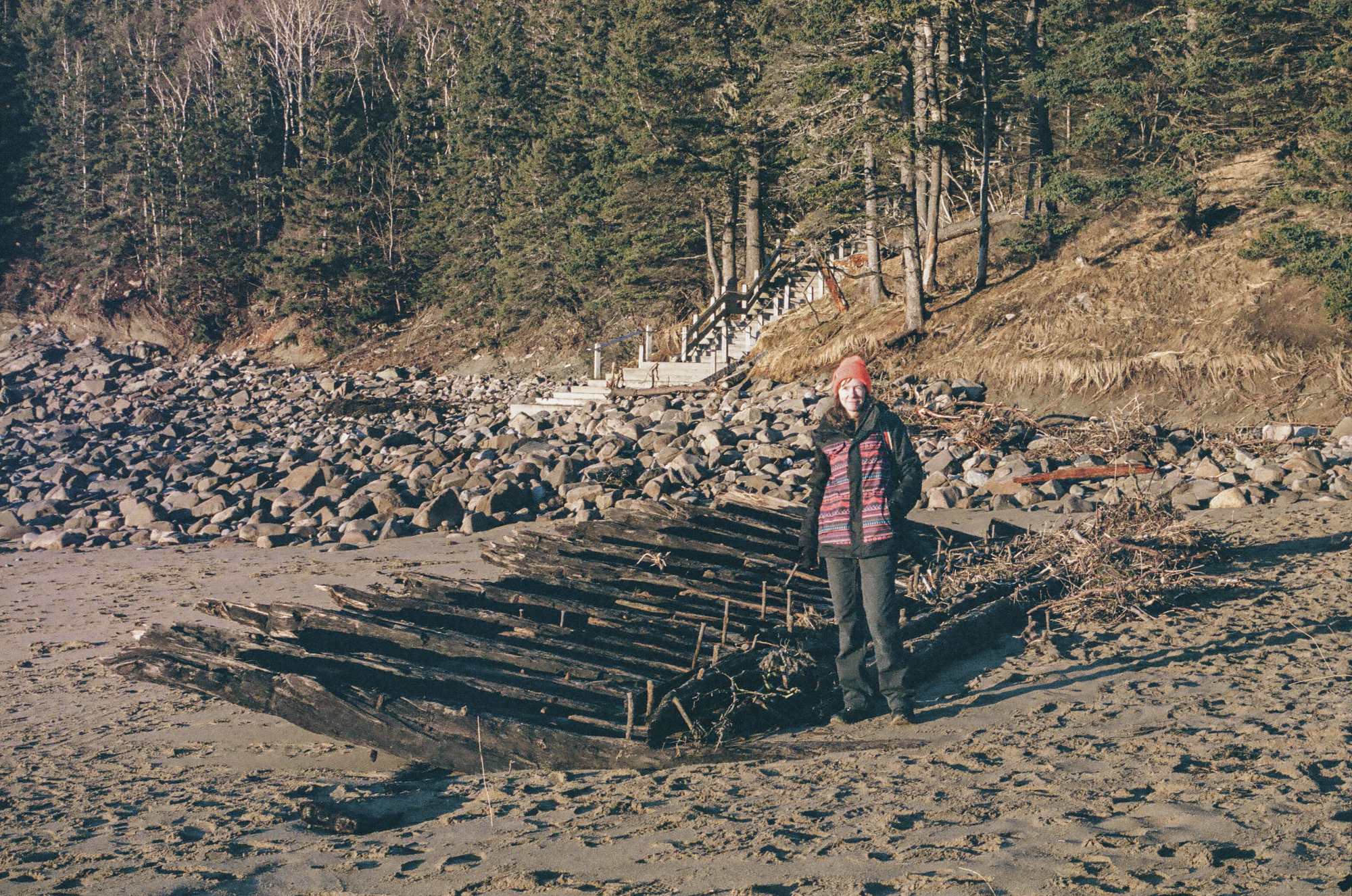
In addition to causing significant damage across the park, back-to-back storms in January 2024 uncovered the Tay, a shipwrecked Canadian lumber schooner. These wooden sailing vessels carried lumber and coal between New Brunswick, Portland, Boston, and other ports.
This wasn’t the first time the wreck, which dates to 1911, was exposed. Every few decades, it seems, Acadia experiences storms with large waves and southerly winds strong enough to erode the dunes and pull sand off the beach.
A storm in November 1950 exposed the Tay, which remained partially buried at least through 1960, when Bar Harbor Times writer LaRue Spiker described how “the ribs of an old wreck snaggle up out of the sand about midway of the beach.”
According to National Park Service records, the Tay became exposed again in Autumn 1964 and December 1969. There are photos of the wreck from 1972, 1979, and 1985, suggesting continued periodic exposure as the seasonal storm cycle eroded and replenished sand on the beach. Like many beaches on the Maine coast, Sand Beach tends to have a lower profile in the stormy winter season, and regain sand during the summer months as prevailing winds shift.
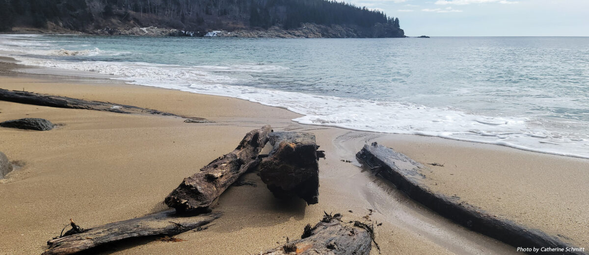
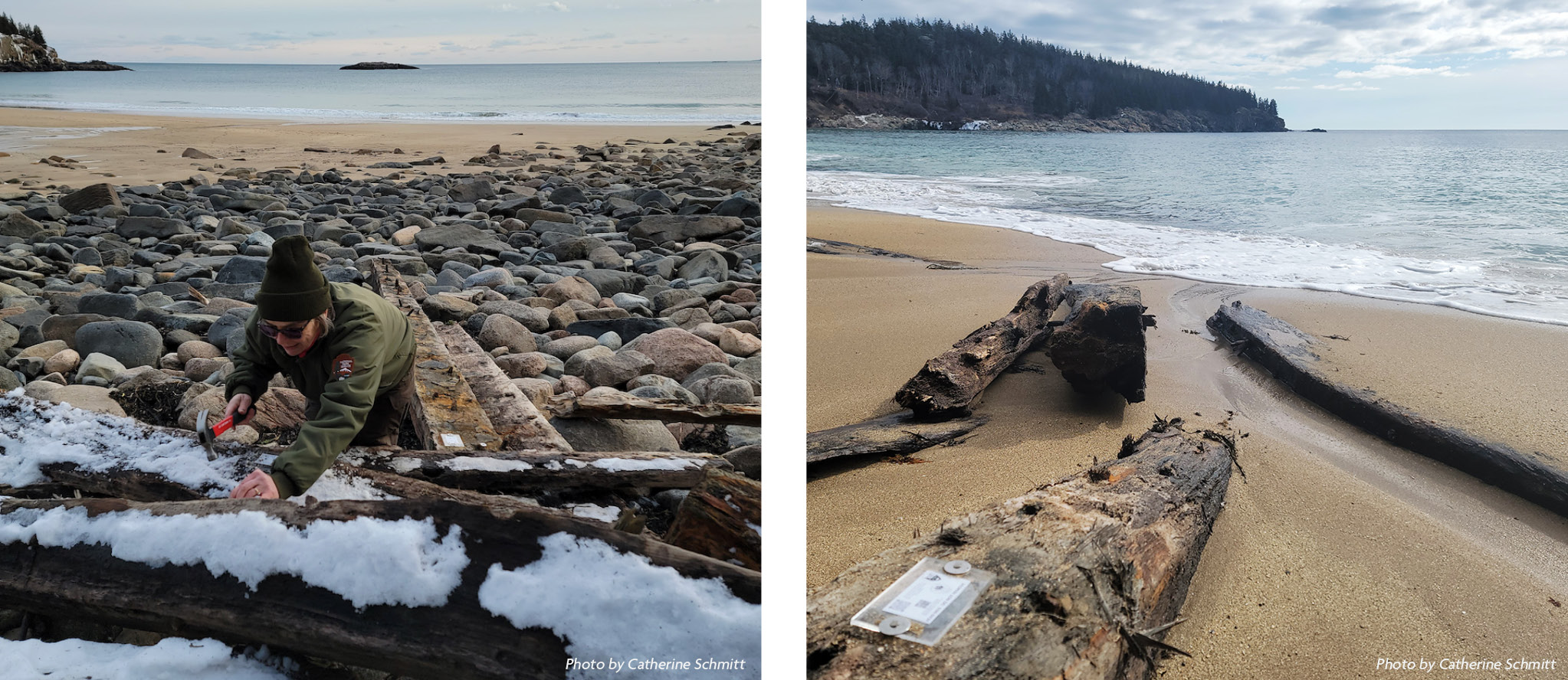
In January 2024, however, sustained high water levels and repeated flooding from high tides moved the wreck, which broke apart as it battered against the exposed, rocky floor of the beach. In late January, Acadia National Park staff photographed, measured, and mapped the remaining timbers. They attached tags to the larger pieces that will allow the wreck to be tracked if pieces continue to move or float away. Each tag has a unique code that visitors can scan using the camera on their mobile phones. The tagging is coordinated by the Shipwreck Tagging Archaeological Management Program (S.T.A.M.P.) of the National Park Service Submerged Resources Center.
Because Sand Beach is located in a cove sheltered on both sides by rocky headlands, when sand is washed away from the beach it doesn’t go very far. Within just a few weeks of the tagging, sand had almost completely buried the timbers of the Tay and covered most of the rocks.
Then, another southeasterly storm in March removed the sand and carried away the timbers, leaving no trace of the Tay. But with the help of visitors tracking the tagged pieces, the story of the wreck will surely continue.
Read more about the history of the Tay at nps.gov and in Chebacco, the magazine of the Mount Desert Island Historical Society.