story + photos by Catherine Schmitt
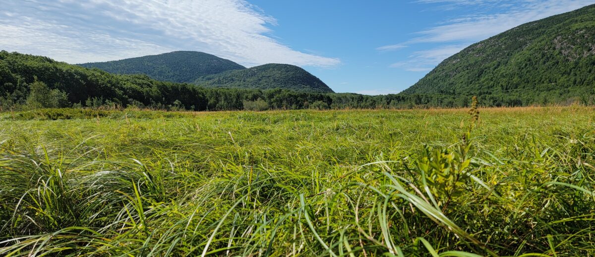
Between the mountains of Acadia are valleys, where the last great glacier ground away at softer earth and lobes of ice lingered. In their wake, a rising sea rushed in, drowing the low-lying areas and depositing a layer of marine silt and clay. The land, eventually realizing it no longer carried the burden of a mile-thick ice sheet, rose out of the sea. Some of the deeper basins drained their salt, took on fresh water, and became lakes. The shallower flats became wetlands; some of the wetlands became meadows: Fresh Meadow, New Mill Meadow, Oak Meadow, Gilmore Meadow, Little Meadow, Great Meadow.
Plant ecologists call them “emergent marshes” or “graminoid wetlands,” for the abundance of sedges, rushes, and grasses that flourish in the meandering water. Moving ever so slowly down almost imperceptible slopes, melted ice, snow, and rain eventually form streams and brooks. There might be shrubs and trees along the banks (alder, swamp maple, meadow willow, meadowsweet); there might be beavers and muskrats, meadow voles and meadow jumping mice, and swamp sparrows and meadowhawk dragonflies. The streams leave the meadows carrying nitrogen, carbon, and other nutrients into the ocean, sustaining coastal food webs.
Ice, sea, rain: these are the forces that shaped—and continue to shape—Acadia. The rain that falls today on ice-rounded summits still flows downhill. But the power dynamic is shifting. Too much rain washes out stream channels, or floods the meadows too fast. Meadows of course were made for this, their sticky soils and roots of thirsty plants soaking up water. But even meadows can be overwhelmed.
Over the last few decades, the Great Meadow has experienced damaging floods as more frequent and intense rain falls on a landscape altered by historical logging, ditching, excavating, road-building, and damming.
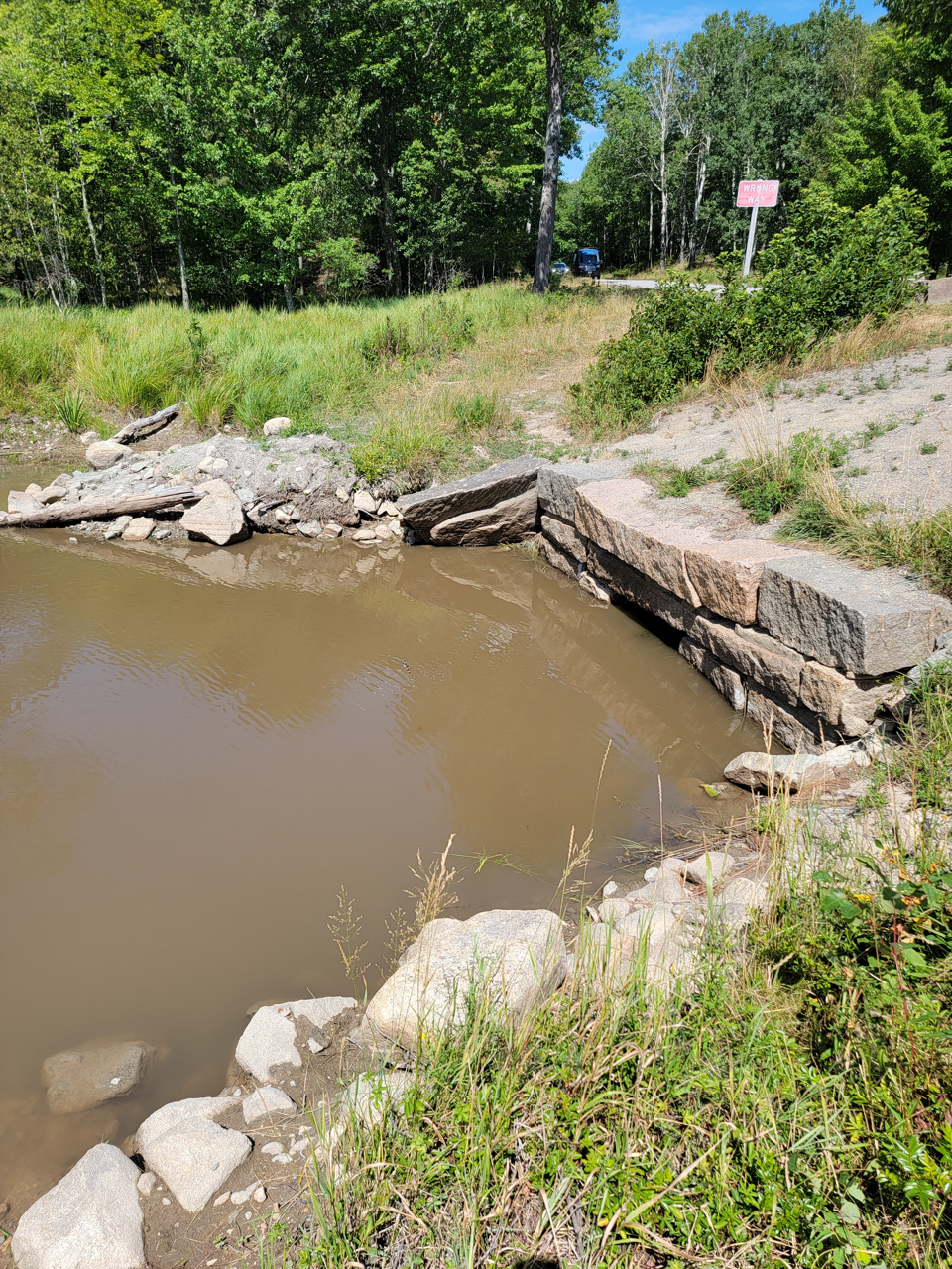
Acadia National Park co-founder George Dorr was responsible for much of it. He built a dam upstream of the Great Meadow, flooding what had been called “Little Meadow” and its small pool into a larger pond he named “The Tarn.” His relationship with the land and water differed from that of Wabanaki people, whose ancestors understood the seasonality of flows in the meadows and the brook that connects them, which formed an inland navigational route between what is now Cromwell Cove and Otter Creek. But the dam, and Dorr’s network of roads, bridges, and trails, interrupted the flow of water. Then, in the 1930s, Civilian Conservation Corps crews dug up portions of the Great Meadow, transporting the rich loam to new trails being constructed along Ocean Drive.
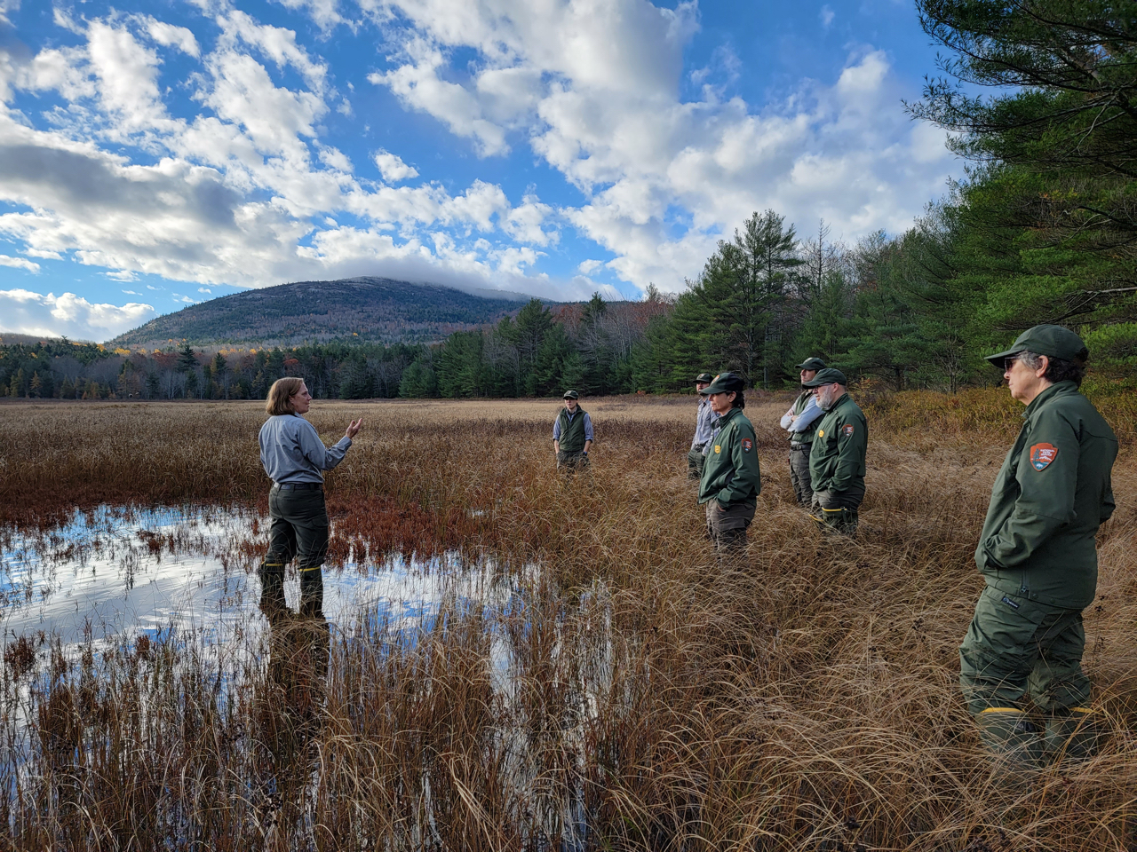
And so the “Great Meadow,” the largest meadow in Acadia, does not function like a meadow. The culvert that carries Cromwell Brook underneath the Park Loop Road is too small, and quickly becomes clogged during heavy rain storms. Without the depth of organic soil, Great Meadow can’t absorb the excess water, which then backs up into the Wild Gardens and Sieur de Monts area. Once the culvert is cleared (usually by park staff), water drains quickly, flowing out through the straightened stream channel and old ditches. Rapid drainage means Great Meadow generally holds less water, and is quick to dry out during drought, said Kate Miller of the National Park Service.
Miller, who regularly monitors 50 wetland locations in Acadia, said the plants in Great Meadow, such as lake sedge (Carex lacustris), Canada bluejoint (Calamagrostis canadensis), willows (Salix spp.) and other shrubs, are tolerant of these extremes, and some have invasive tendencies and quickly take over the forested edges if left unmanaged, such as glossy buckthorn (Rhamnus frangula).
In contrast, take Gilmore Meadow, a similar wetland linked to Aunt Betty Pond and Richardson Brook in the shadow of Sargent Mountain. The surrounding forests were logged in the 1880s, and a carriage road borders one edge, but otherwise Gilmore Meadow was not subjected to the same level of landscape disturbance as Great Meadow. As a result, it doesn’t drain as quickly. It has a thick layer of springy soil, fewer shrubs, and more “wetland obligate” species like wire grass (Carex lasiocarpa), Northwest territory sedge (Carex utriculata), and tussock sedge (Carex stricta).
The sedges shimmer in the sunlight, ripple in the wind like waves, echoes of the ocean that once covered all of the land that became Gilmore Meadow and Great Meadow. You can see that ancient sea, still, if you imagine the base of the surrounding hills as shoreline, or dig down to the dense blue-gray mud that forms the foundation for the meadows. The deep past also provides inspiration for how they might survive the future.
Compared to Gilmore Meadow and other wetlands in Acadia, Great Meadow is impaired. However, the water is clean, and the park’s vegetation crews, led by Jesse Wheeler, have been vigilant in removing invasive plants. This makes the Great Meadow primed for restoration – because it has not strayed too far from the meaning of a meadow.
Learn more about work with Acadia National Park and Friends of Acadia to help Great Meadow be more resilient to a rapidly changing climate, and how you can help at nps.gov.