The Maine coast is experiencing warming ocean temperatures, rising sea levels, and intensifying storms. Particularly vulnerable to these changes are areas of the intertidal zone known as mudflats. Expanses of unvegetated, soft sediments exposed at low tide, mudflats provide habitat for worms, crustaceans, and other invertebrates that are food for fish and birds. Mudflats cycle nutrients, sequester carbon, and protect shorelines. Mudflats also support wild clam fisheries and one of the only baitworm fisheries in the United States.
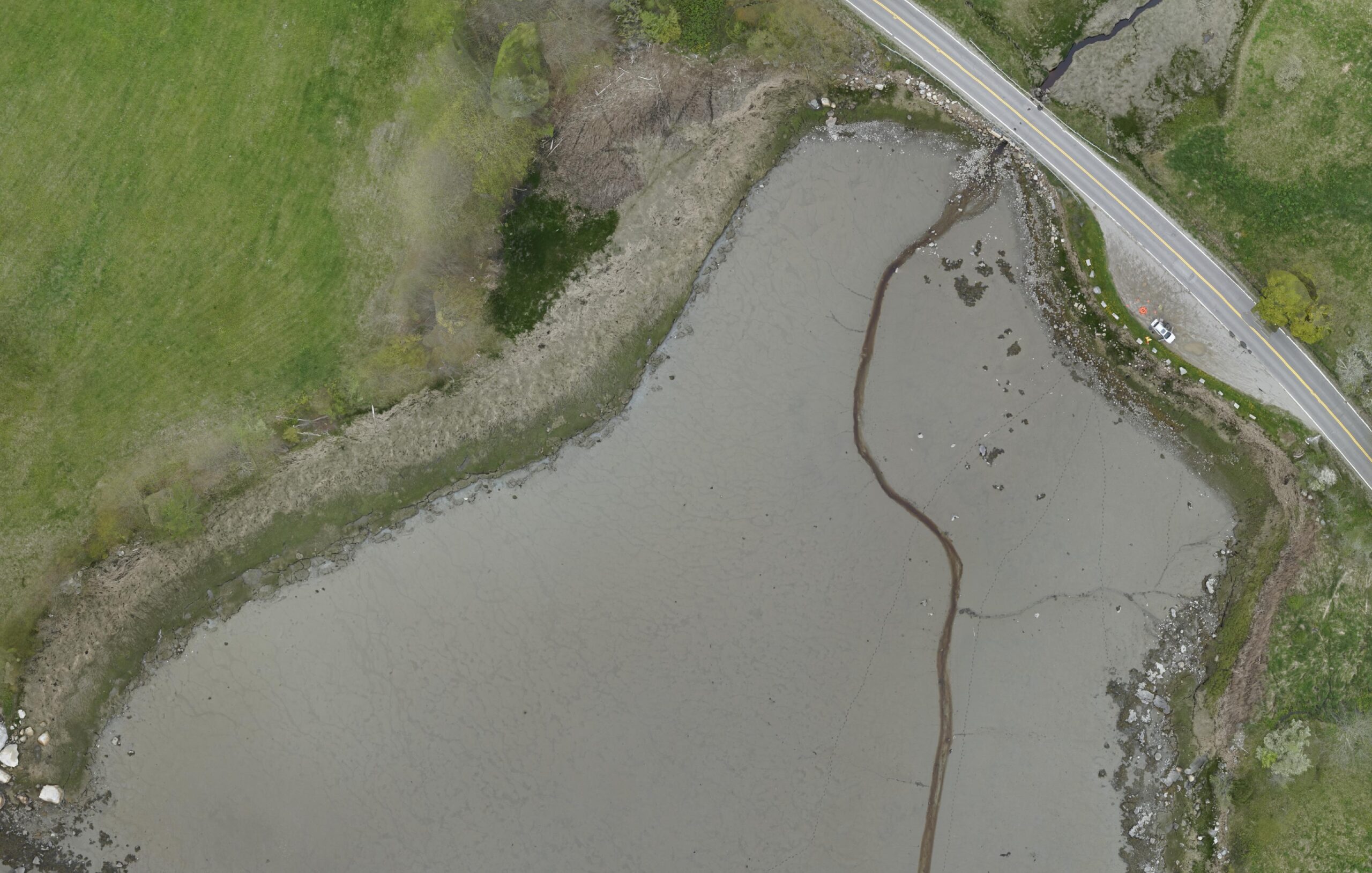
Trends observed by clam and worm harvesters include a growing presence of mats of green algae which negatively impact clams, “dead mud” without any clams, and increasing erosion of mudflats. Their work is disrupted by storms that can move and redistribute sediment, shifting harvest areas. However, it is unclear how storms affect the relationship between sediment type and clam and worm populations, and whether any patterns can be generalized.
The Mapping Mud Project, funded by the Maine Coastal and Marine Climate Fund, is building upon ongoing efforts to map mudflat habitat in the Bagaduce and Scarborough estuaries, and identify coastal vegetation based on unique light reflectance signatures using data acquired via drone, or Unoccupied Aerial System (UAS). In collaboration with Manomet Conservation Sciences and Nearview LLC, as well as marine resource harvesters, the goal is to characterize relationships between mudflat sediment and clam and worm populations, and how they are affected by storms.
In 2025 and 2026, we will use UAS in combination with the collection of biological data to develop baselines, models, and indices to identify the sediment spectral signatures and topographic conditions (e.g., elevation, slope) associated with intertidal mudflats, and relate these data to the relative abundance of intertidal shellfish and baitworms. The research takes place in Georges River, which hosts one of the most productive clam fisheries in the state, and Northern Bay of the Bagaduce River, where productivity is limited. Both of these mudflats are in municipalities with active shellfish commissions, thus have management and conservation efforts underway.
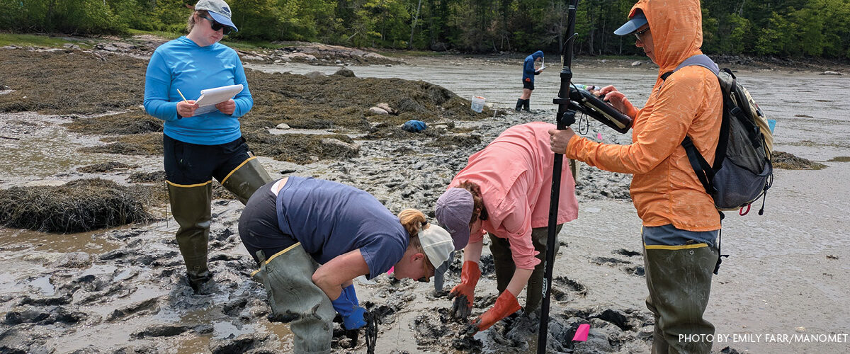
We aim to grow coastal community capacity to monitor changes to mudflats through time and after storms. We will engage with clammers and worm harvesters to understand the opportunities and barriers to collecting (and sharing) mudflat data. These discussions will inform development of technical guidelines (or a “best practices” document) for communities to do their own data collection via drones, along with training for harvesters and other community members.
Creating such tools, and capacity to use them, are critical to developing a regional baseline understanding of, and predicting how, mudflat conditions may change with storms and under future conditions with higher rates of sea level rise.
For more information, contact Hannah Webber.