Schoodic Institute Press Release
Encircling the polar region of the northern hemisphere, the Arctic tundra is home to numerous Indigenous communities and cultures, and supports unique plants and animals. The Arctic is also warming rapidly, resulting in transformation of the tundra that influences the global carbon cycle and climate systems. What happens in the tundra of the far North has the potential to affect everyone on Earth.
The tundra’s vastness and relative lack of infrastructure makes it a challenging place for scientists trying to monitor and understand these changes.
In an article published today in the Journal of Geophysical Research: Biogeosciences, Schoodic Institute Forest Ecology Director Peter Nelson and 19 co-authors present an assessment of these challenges and the opportunities presented by imaging spectroscopy, a rapidly advancing field of remote sensing that measures reflected light in narrow bands of “color” from satellites, aircraft, towers, or the ground.
“We have already found that this imaging can show us how key land surface properties–such as Arctic vegetation–vary across space and over time,” said Nelson. Nelson is part of a large group of research teams who have been using such imaging to study plants, moss, and lichen, funded by NASA’s Arctic-Boreal Vulnerability Experiment (ABoVE) and other agencies. They collect information about vegetation type and extent, visiting places on the ground and making observations remotely from above using spectrometers on drones, aircraft, and satellites. Relating the two sets of data allows them to estimate plant traits such as canopy nitrogen, leaf mass, water content, and photosynthesis, as well as to identify and map land cover, biomass, and even plant genetic diversity at local to regional scales.
The researchers conducted their study by synthesizing numerous data sets in anticipation of NASA’s launch of a new Earth System Observatory in 2027. The Surface Biology and Geology component of this observatory will include an imaging spectrometer that measures more and different bands of reflected light, greatly enhancing global observation, including coverage of Arctic regions, from space.
“When people think of NASA, they imagine astronauts on the International Space Station or rovers on Mars, but NASA has a significant program to use space science to study our home, the Earth. NASA is presently conducting a major field study of high northern ecosystems called the Arctic-Boreal Vulnerability Experiment (ABoVE),” said co-author Fred Huemmerich, professor at University of Maryland Baltimore County and a scientist at the Goddard Space Flight Center.
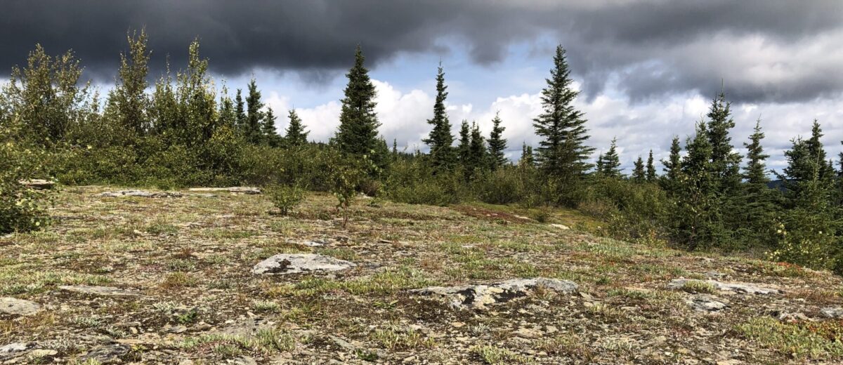
Interpreting data from the Arctic, however, is complicated by the tundra’s unique and complex features. The “tundra” is not a homogenous swath of sedge, but a highly variable mix of communities, from low-growing lichens in the Izaviknek Hills of Alaska and the mosaic of shrubs, wetlands, and streams in the Yukon Delta, to the moss-crusted Franz Josef Land in Russia and thawing permafrost of Siberia. Even a five-meter patch of tundra can have many different types of vegetation and ground cover, including non-vascular plants that have different spectral signals. Plants grow differently in the tundra, making it hard to detect long-term trends.
“In our analysis, I was struck by how vegetation considered ‘dominant’ could have tiny plants a few centimeters tall or grow in patches kilometers in size. The colors or reflectance of these plants also ranged widely across the wavelengths studied. Take this complexity and add the fact that the whole growing season is compressed into a few short months and the huge physical size of the biome, and we have a real issue monitoring the rapid change as it is happening across the Arctic,” said Nelson.
Arctic seasons, weather, and climate also present a challenge. Short but intense growing seasons mean that flowering and foliage changes may go undetected. Frequent clouds, snow and ice much of the year, as well as intermittent standing water, generally interfere with images of reflected light. Smoke from wildfires and atmospheric humidity also frequently obscure views of the ground during the growing season. Extreme variations in day length and solar radiation can make it hard to interpret “snapshot” observations of dynamic plant processes.
“Despite these challenges, we think imaging spectroscopy enables us to achieve several common goals for advancing our understanding of the Arctic tundra, including detecting both long-term and seasonal change, classifying land cover and vegetation type, and estimating plant functional traits,” said Andrew Maguire, a postdoctoral fellow at NASA’s Jet Propulsion Laboratory and co-lead with Nelson of the journal article.
Maguire and Nelson also noted that the article is the product of highly collaborative work among scientists representing a wide range of career stages and areas of expertise. “The study process was enjoyable, enlightening, and amplified our individual insights to generate a more comprehensive and impactful scientific output than any subset of us would have achieved alone,” said Maguire.
“I really loved being a part of this collaborative effort. I felt immediately welcomed into the project despite joining late and as a graduate student. Because tundra remote sensing requires expertise in a broad range of backgrounds from ecophysiology to remote sensing, and spans a huge range of spatial and temporal scales, I was able to learn so much from other scientists on the team,” said Zoe Pierrat, University of California Los Angeles.
“One thing that was unique about this collaboration was how author contributions were taken into account,” said Erica Orcutt, Postdoctoral Scholar at the University of California, Davis. “Since we had such a large range of scientists at different career stages, we had a transparent way to determine author order that made for a much more inclusive environment for early-career scientists.”
The authors advocate for research that combines imaging spectroscopy at multiple scales and resolutions, from lab studies to satellites that enable frequent and continuous long term monitoring. In the process, what is learned about Arctic tundra ecology can inform research on other ecosystems, as well as the development of new instruments and sampling designs.